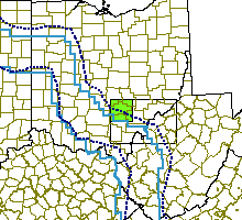


Click near the border to see a neghboring map
Click on treatment blocks (red) to see details
|
|
Click near the border to see a neghboring map Click on treatment blocks (red) to see details |

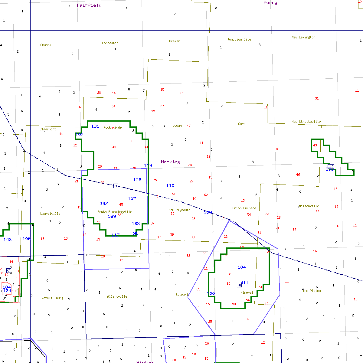


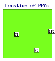
State Area Distance N Max Max Backgr. Priority Delimit Action Action Comment PPA ID sqkm km traps catch before moths index index recommended taken |
OH- 71 183 -1.4 22 589 217 1.811 5.21 0.48 delimit delimit OH- 78 80 6.4 10 411 107 1.617 5.91 0.50 delimit delimit OH-115 17 -17.9 3 253 101 1.938 0.00 0.31 - - |
| ID = | Identification number of the potential problem area (see the map). |
| Distance = | Distance from the beginning of the STS action zone, km. Negative distance means that the PPA is in the monitoring zone. |
| N traps = | Number of traps in the problem area. |
| Max catch = | Maximum number of moths captured within the problem area. |
| Max before = | Maximum number of moths captured in a 3-km neighborhood in the previous year. |
| Priority index = | Shows the priority for STS action (either treatment or delimiting). |
| Delimit index = | Shows how well the area was delimited in the previous year. |
| Backgr. moths = | Mean log moth counts in a 25-km neighborhood. |
See details in: Decision algorithm explained.
 Home
Home