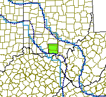


Click near the border to see a neghboring map
Click on treatment blocks (red) to see details
|
|
Click near the border to see a neghboring map Click on treatment blocks (red) to see details |

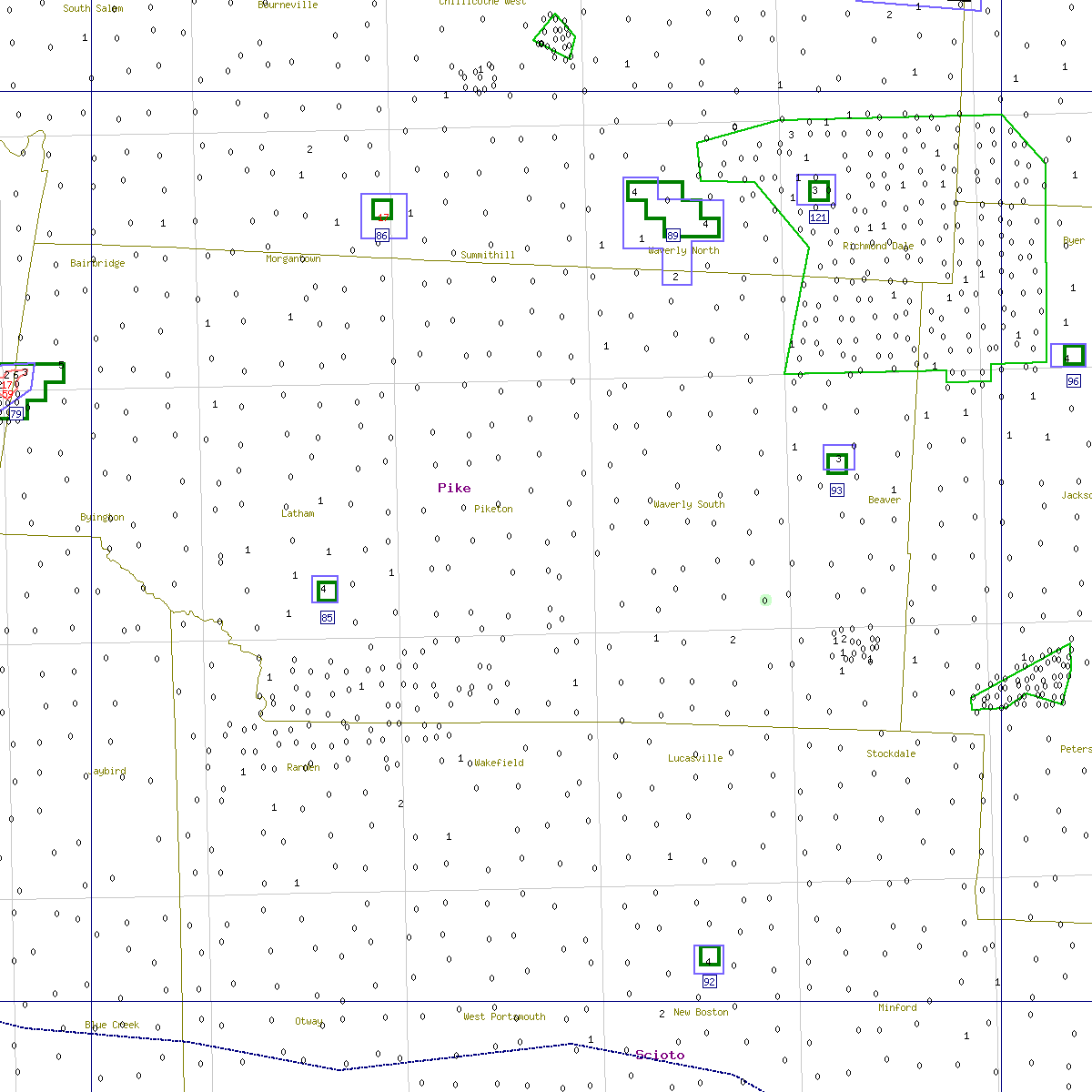


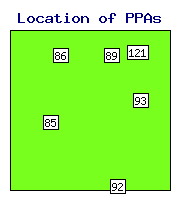
State Area Distance N Max Max Backgr. Priority Delimit Action Action Comment PPA ID sqkm km traps catch before moths index index recommended taken |
OH- 85 1 60.7 1 4 2 0.038 2.51 0.45 delimit delimit OH- 86 1 43.4 1 17 1 0.056 3.51 0.47 delimit delimit OH- 89 9 32.6 4 4 1 0.089 2.06 0.54 - delimit OH- 92 1 69.5 1 4 1 0.035 2.33 0.39 delimit delimit OH- 93 1 42.1 1 3 0 0.062 1.66 0.42 - delimit OH-121 1 28.0 1 3 0 0.116 1.56 0.87 - delimit |
| ID = | Identification number of the potential problem area (see the map). |
| Distance = | Distance from the beginning of the STS action zone, km. Negative distance means that the PPA is in the monitoring zone. |
| N traps = | Number of traps in the problem area. |
| Max catch = | Maximum number of moths captured within the problem area. |
| Max before = | Maximum number of moths captured in a 3-km neighborhood in the previous year. |
| Priority index = | Shows the priority for STS action (either treatment or delimiting). |
| Delimit index = | Shows how well the area was delimited in the previous year. |
| Backgr. moths = | Mean log moth counts in a 25-km neighborhood. |
See details in: Decision algorithm explained.
 Home
Home