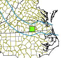


Click near the border to see a neghboring map
Click on treatment blocks (red) to see details
|
|
Click near the border to see a neghboring map Click on treatment blocks (red) to see details |

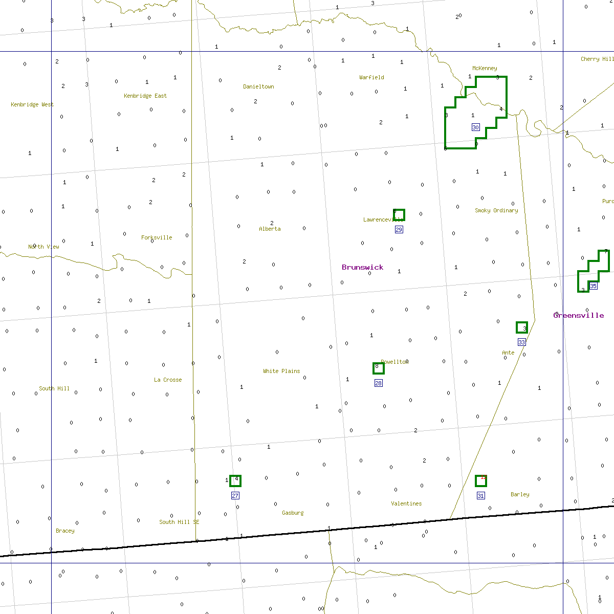

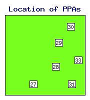
State Area Distance N Max Max Backgr. Priority Delimit Action Action Comment PPA ID sqkm km traps catch before moths index index recommended taken |
VA- 27 1 57.6 1 4 0 0.078 1.91 0.37 - n/assign VA- 28 1 47.4 1 8 5 0.115 3.35 0.26 delimit n/assign VA- 29 1 32.9 1 6 - 0.244 1.75 0.29 - n/assign VA- 30 30 25.6 5 6 - 0.290 1.56 0.47 - n/assign VA- 31 1 60.1 1 12 10 0.106 4.35 0.29 delimit n/assign VA- 33 1 46.9 1 3 2 0.120 1.98 0.34 - n/assign |
| ID = | Identification number of the potential problem area (see the map). |
| Distance = | Distance from the beginning of the STS action zone, km. Negative distance means that the PPA is in the monitoring zone. |
| N traps = | Number of traps in the problem area. |
| Max catch = | Maximum number of moths captured within the problem area. |
| Max before = | Maximum number of moths captured in a 3-km neighborhood in the previous year. |
| Priority index = | Shows the priority for STS action (either treatment or delimiting). |
| Delimit index = | Shows how well the area was delimited in the previous year. |
| Backgr. moths = | Mean log moth counts in a 25-km neighborhood. |
See details in: Decision algorithm explained.
 Home
Home